|
|
| Placer Mining Claims For Sale | ||||||||||||||||||||||||||||||||||||||||||
|
|
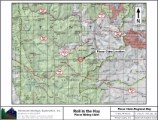
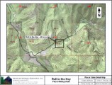
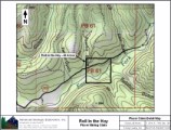
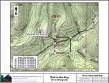
**Trommel Ideal** Roll in the Hay ±40 Acres Price: $15,000
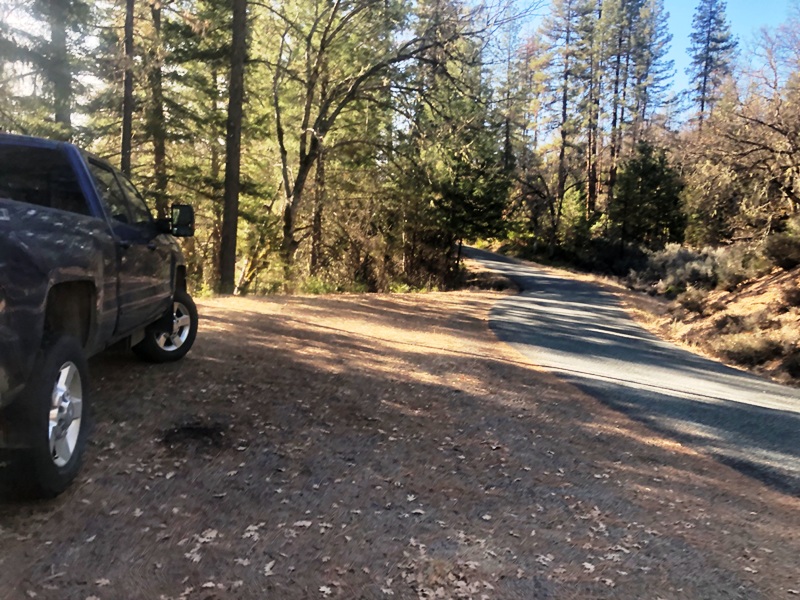
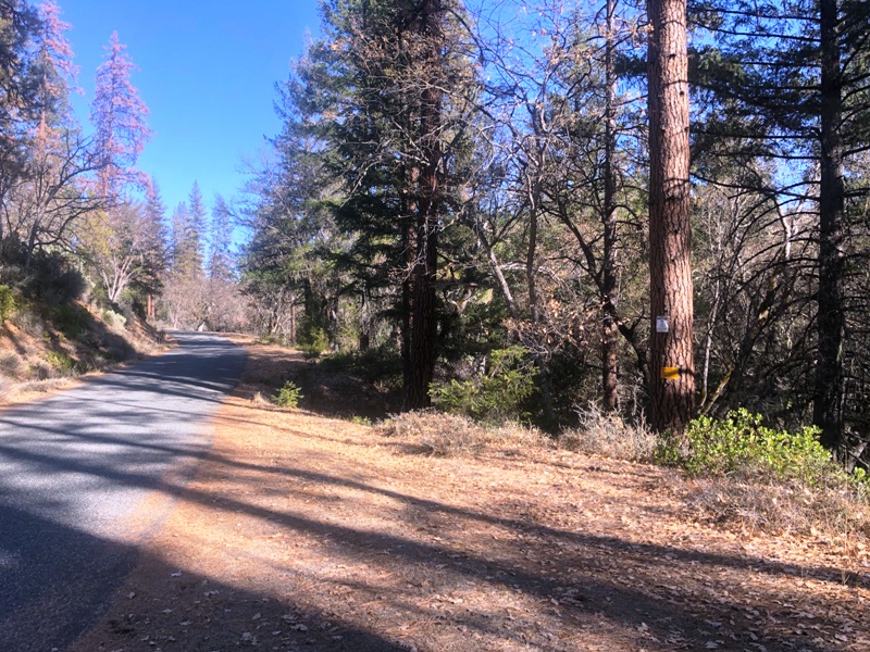
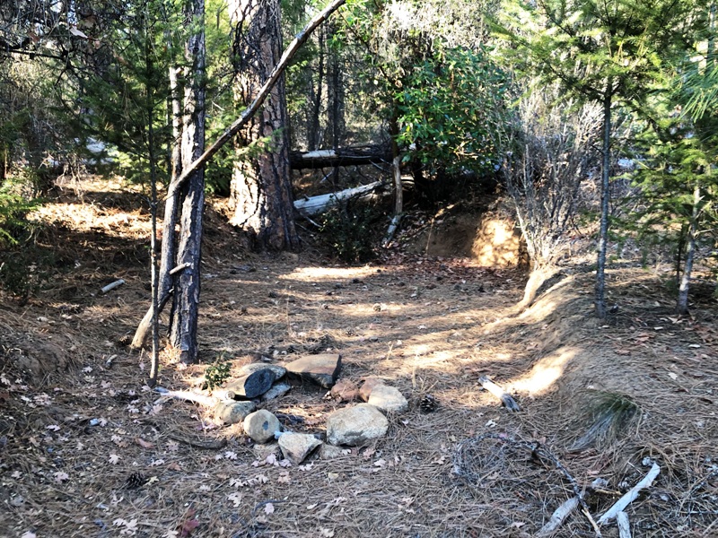
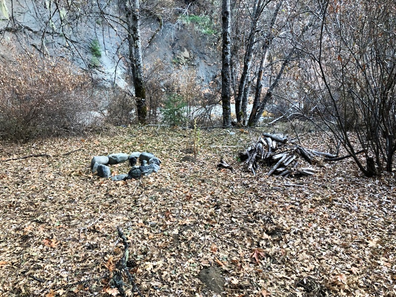
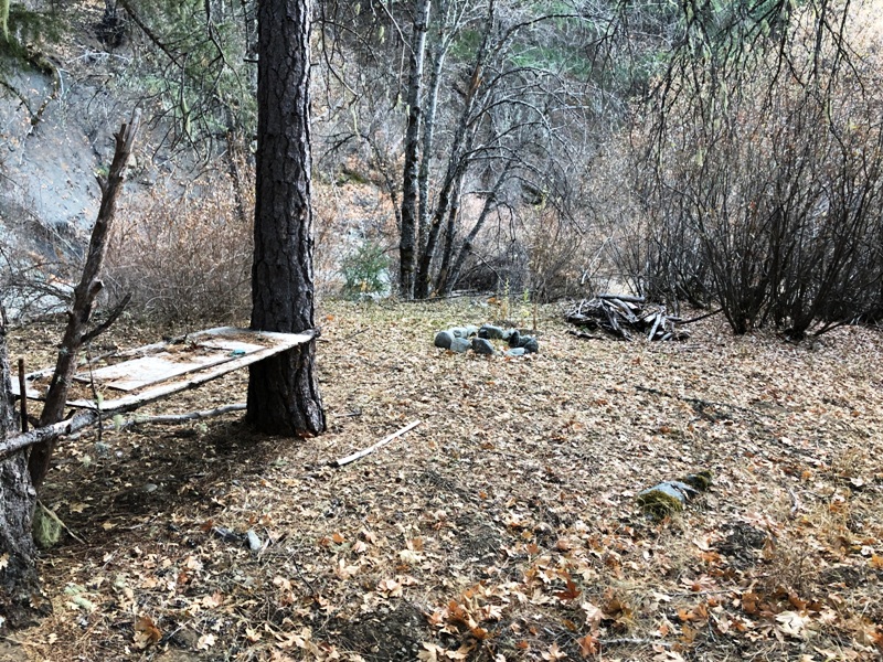
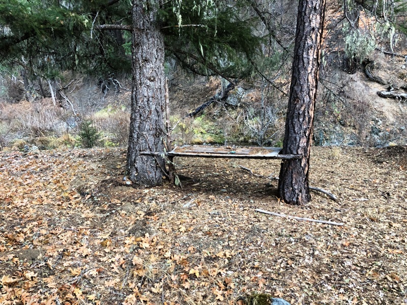
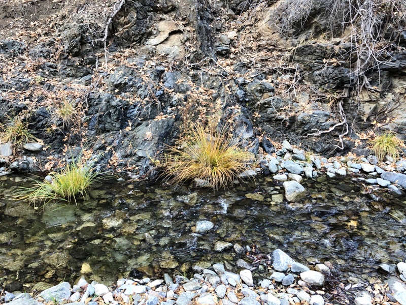
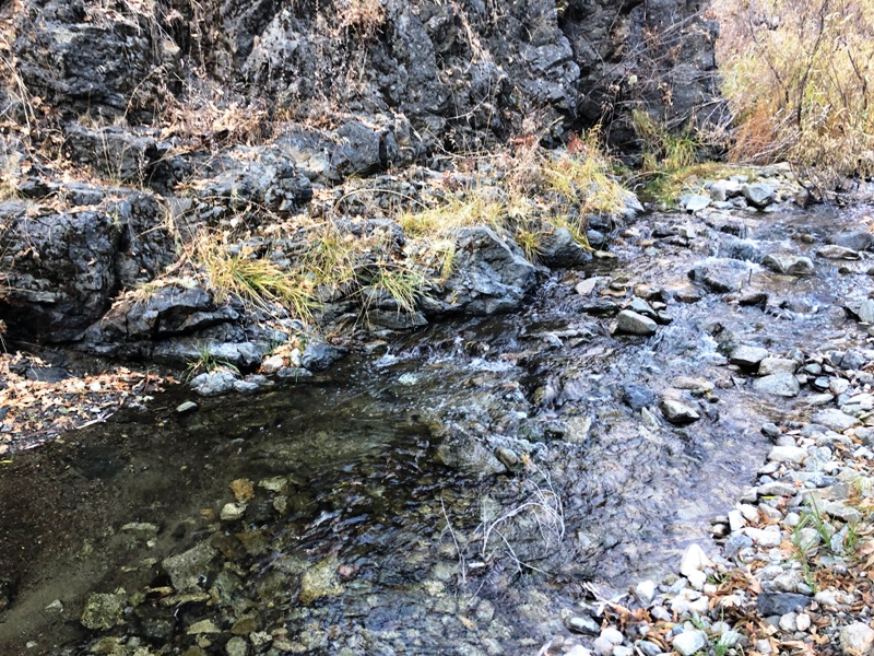
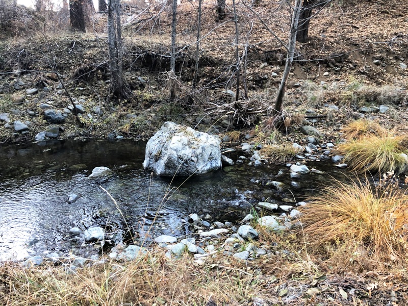
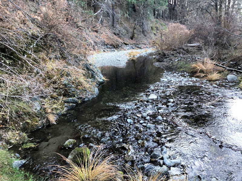
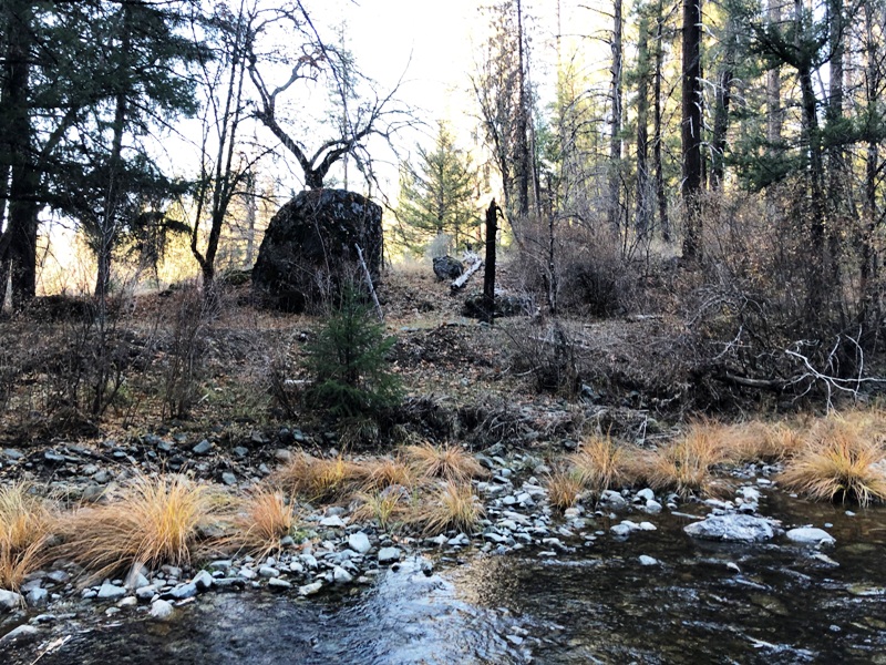
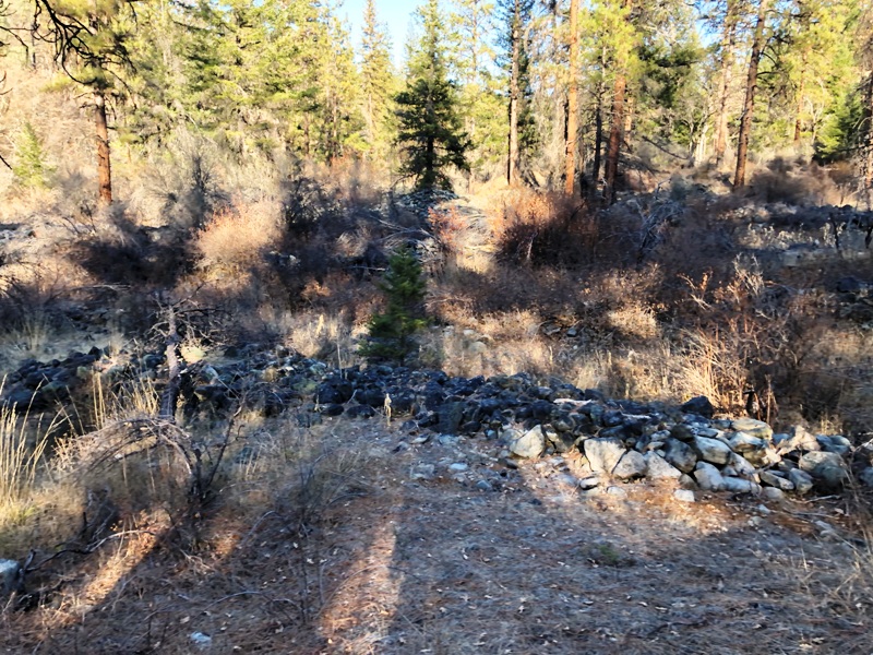
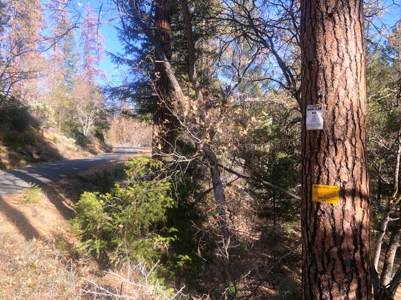
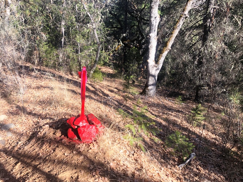
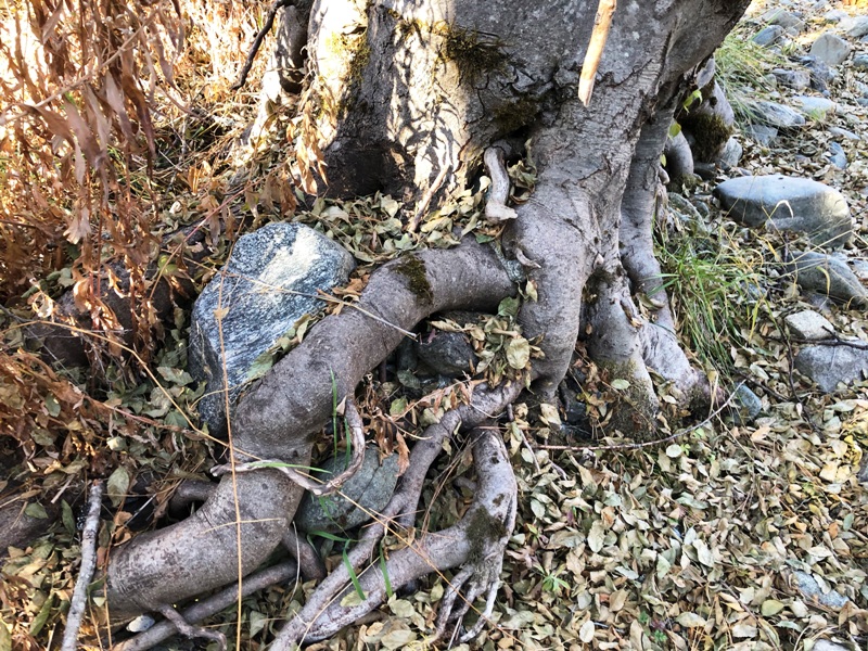
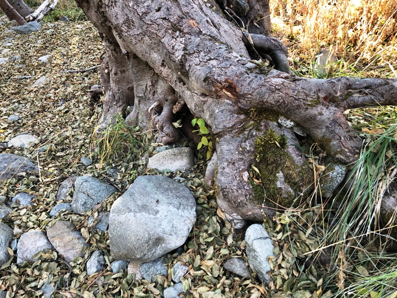
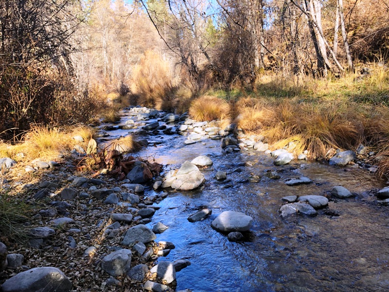
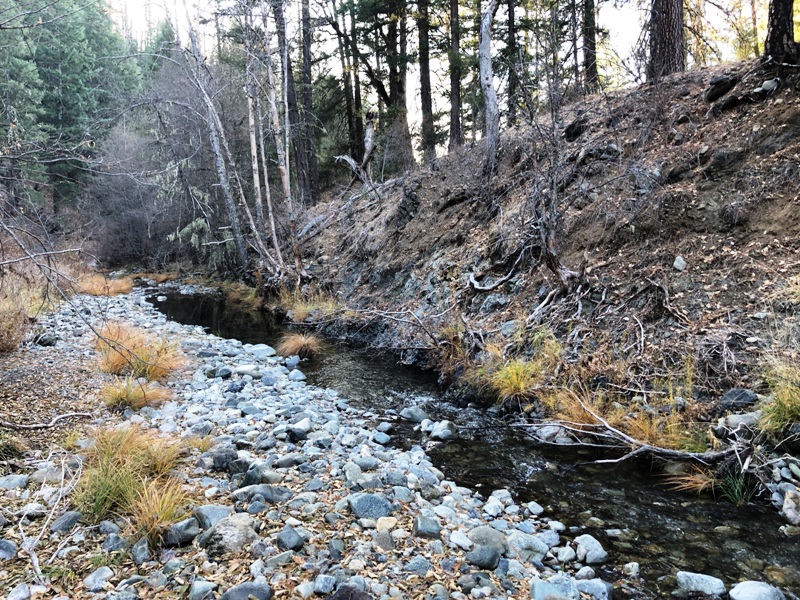
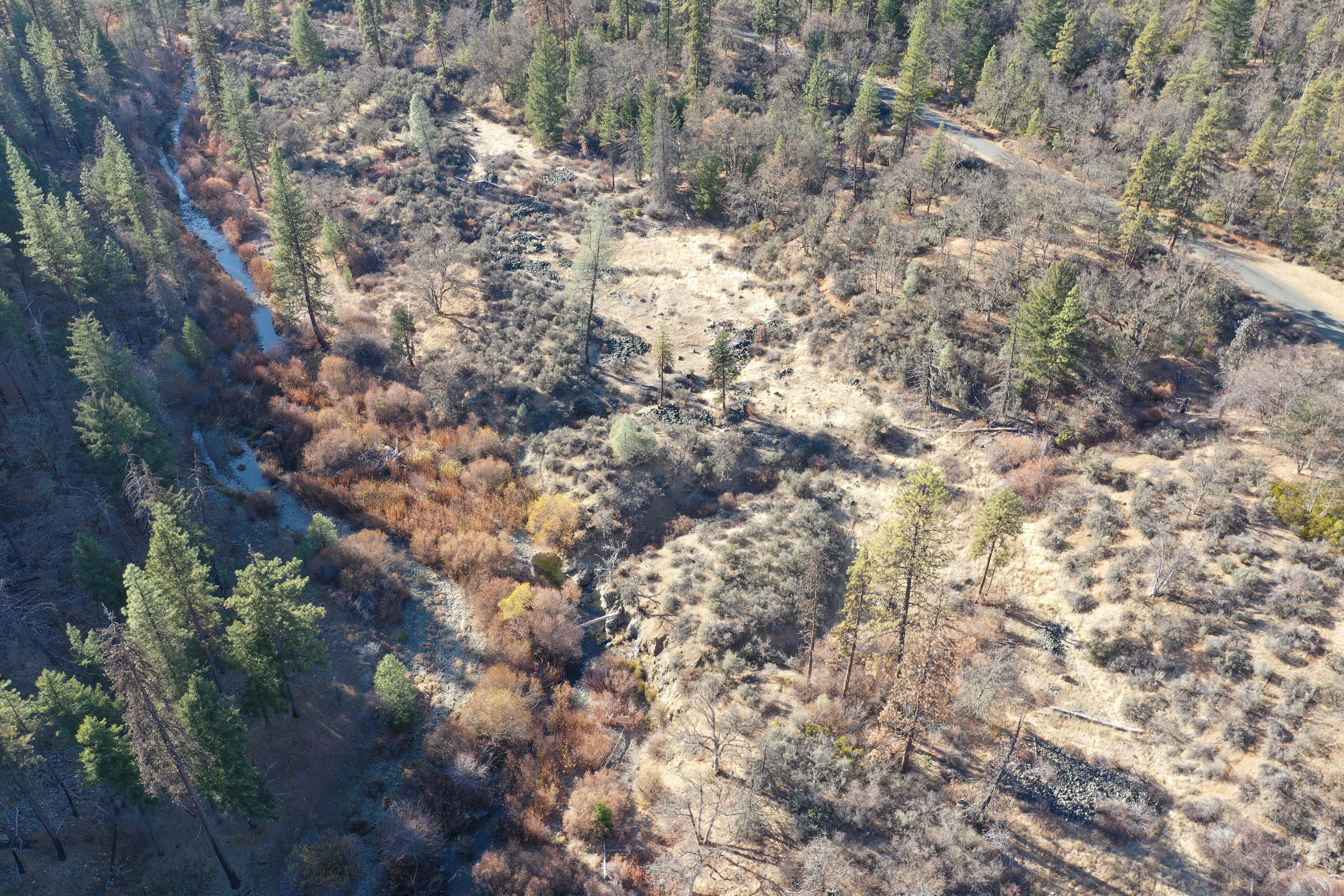
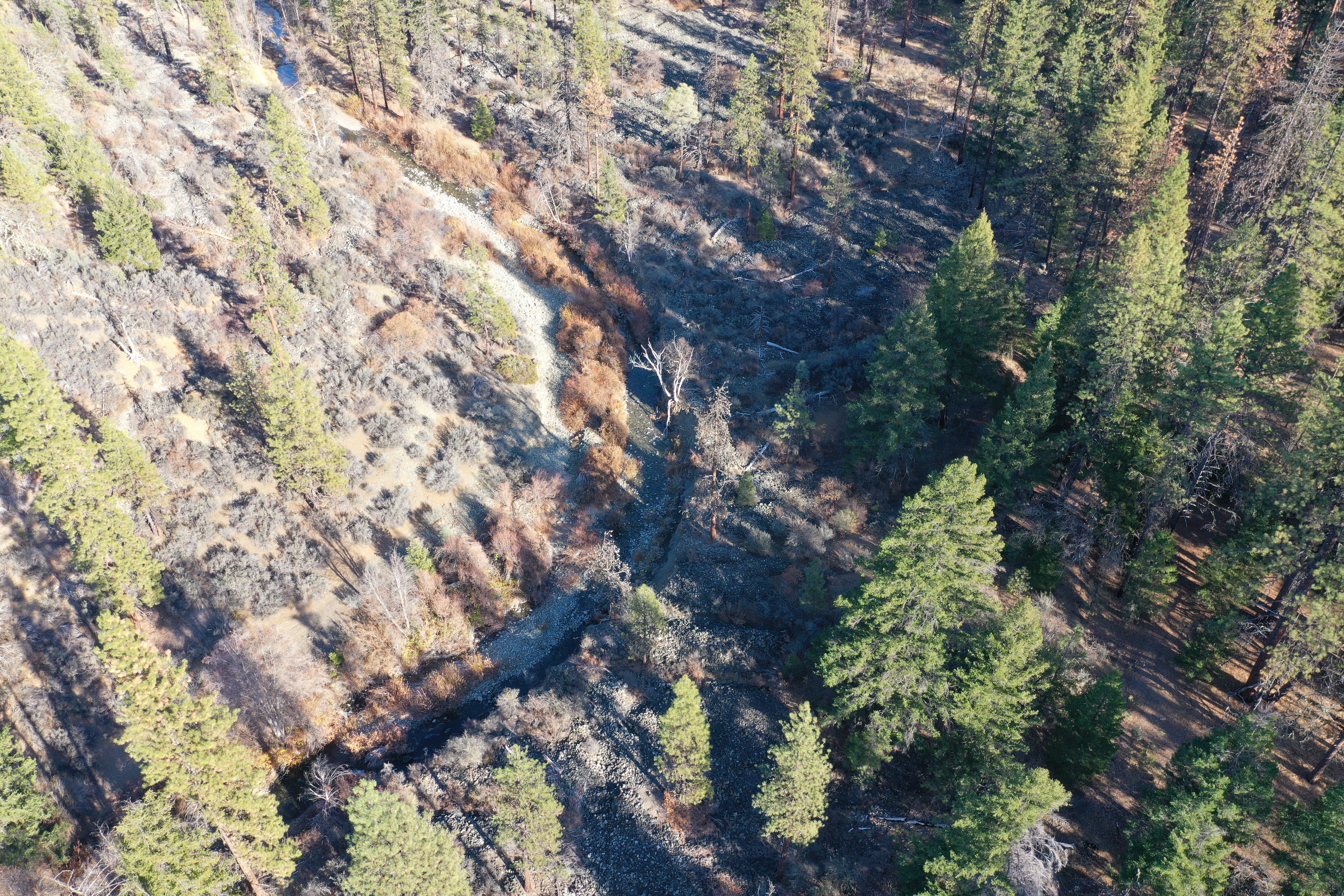
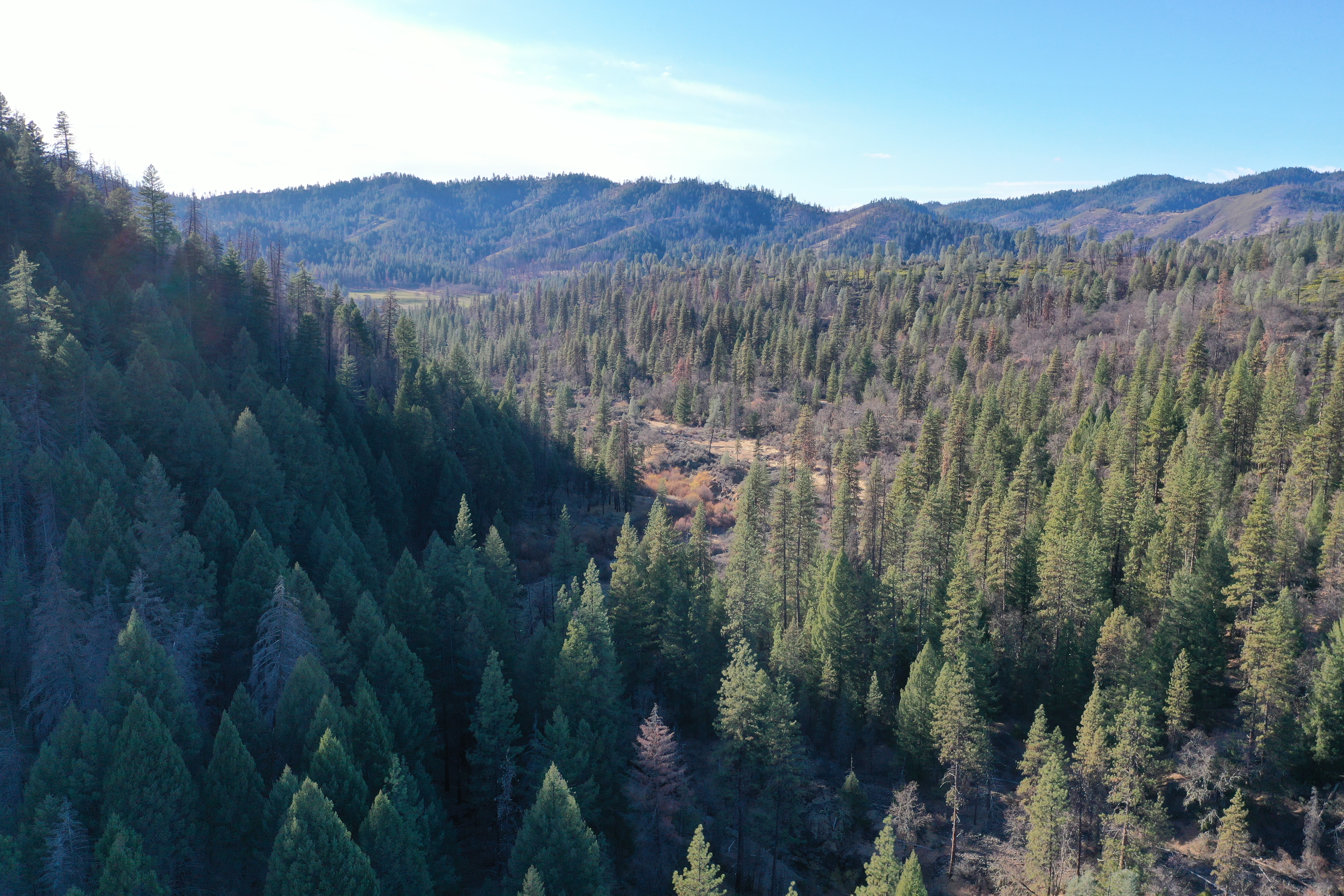
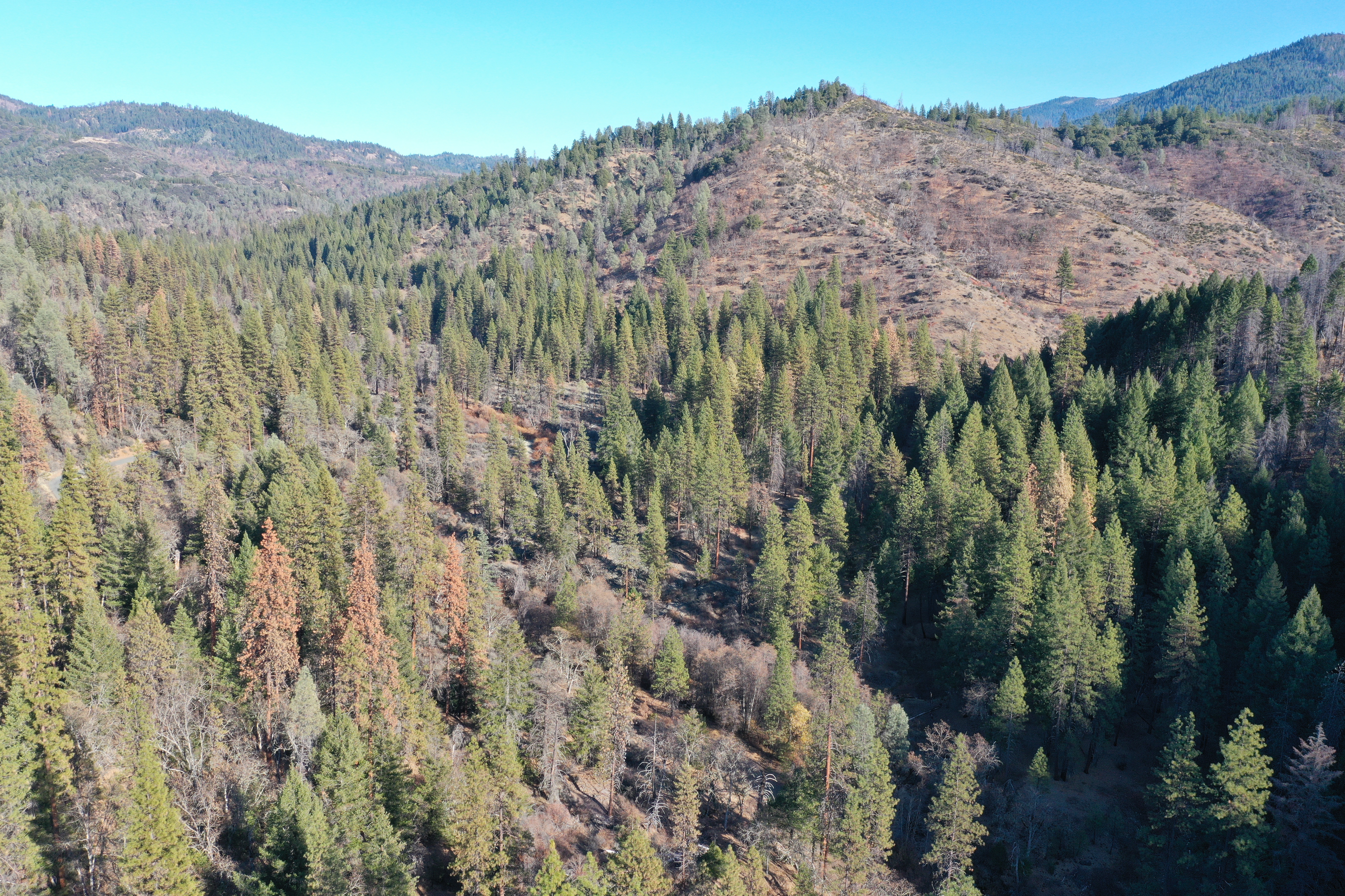
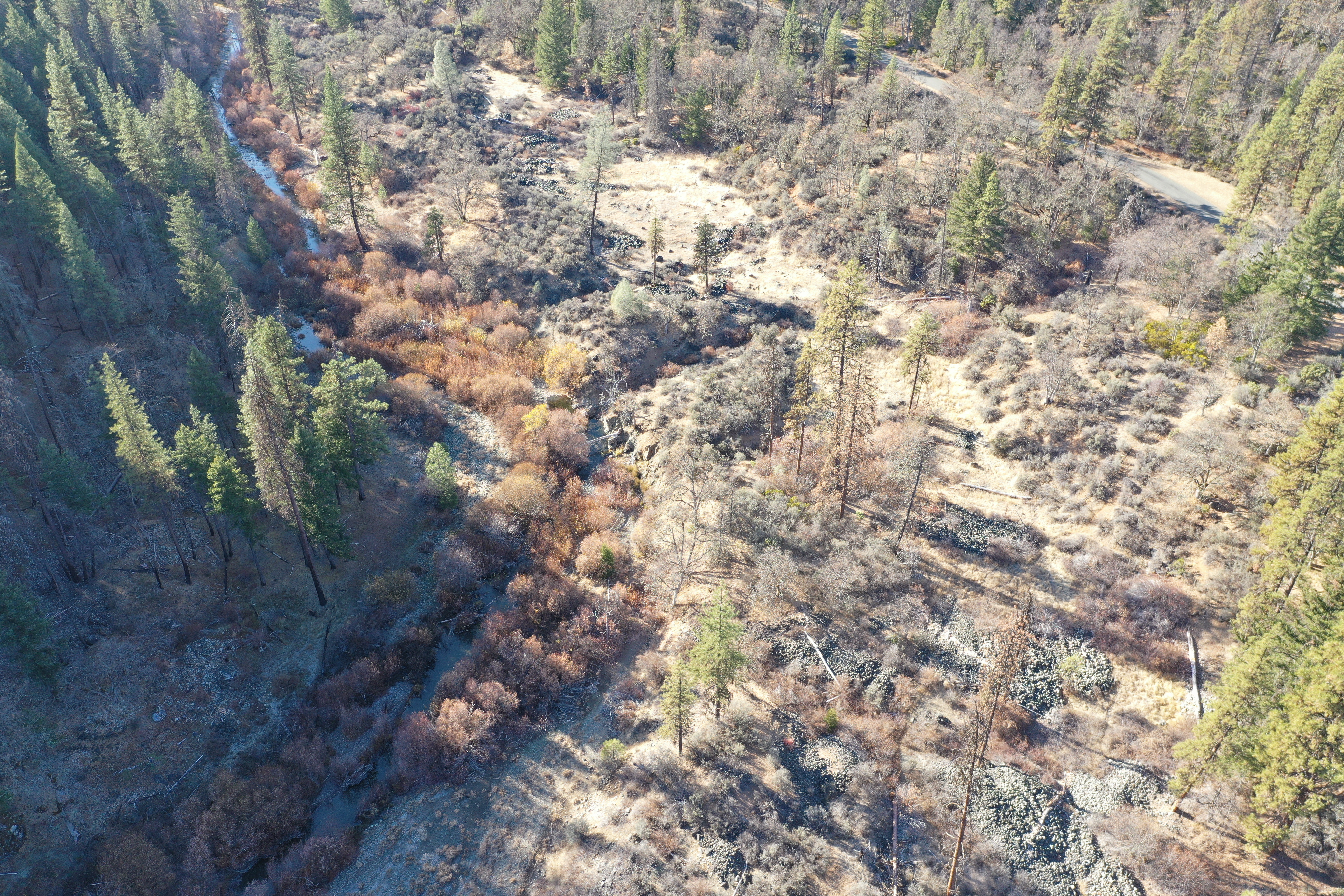
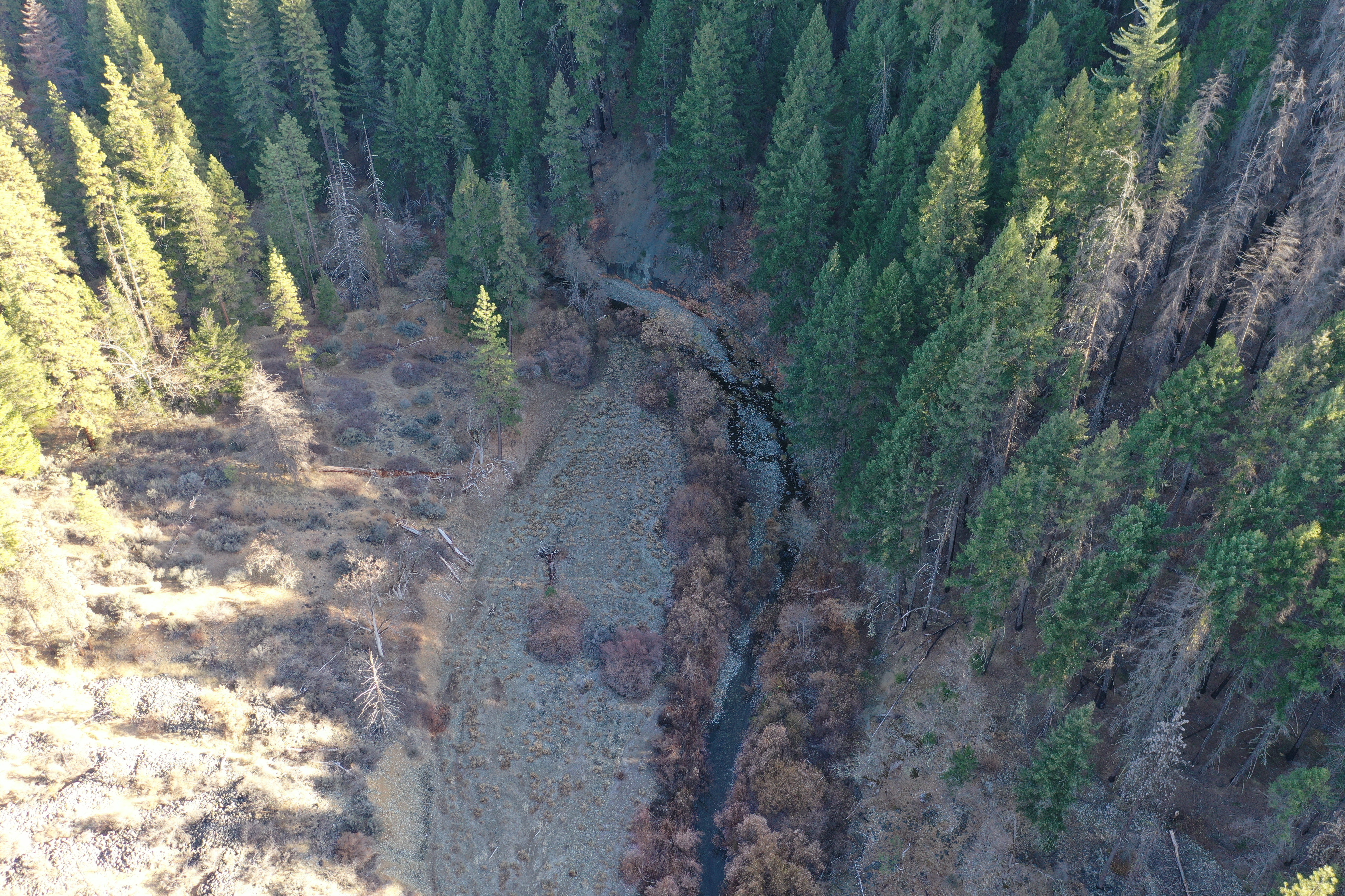
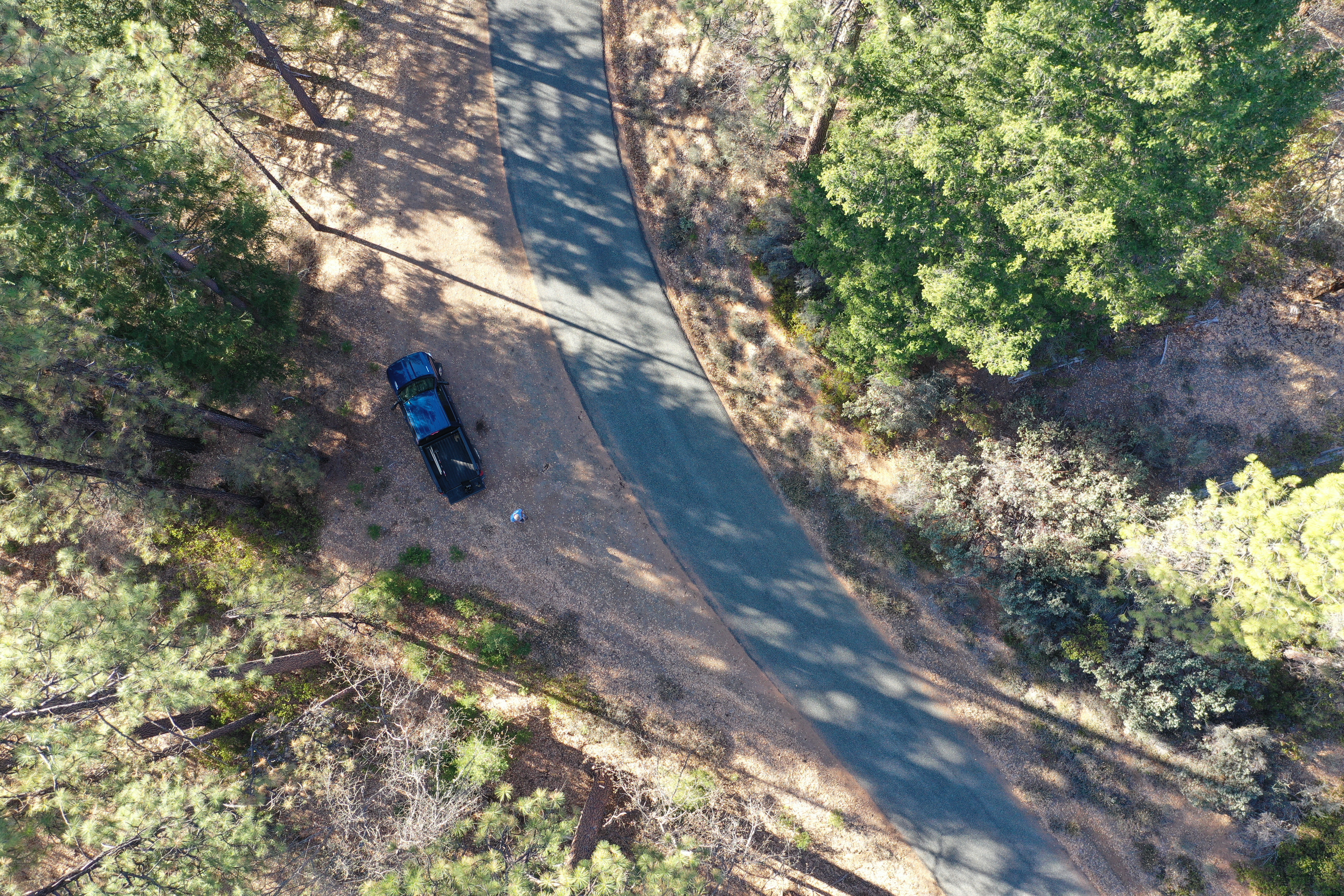
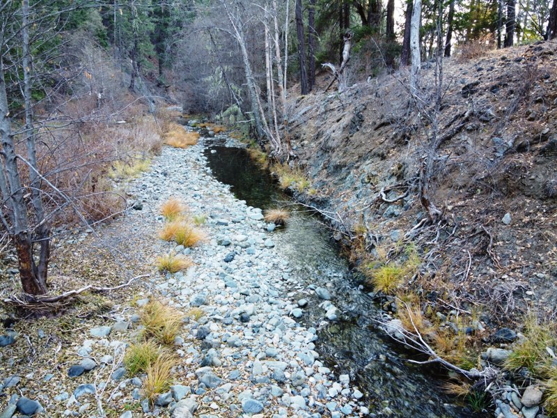
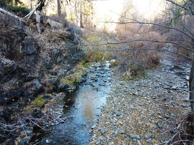
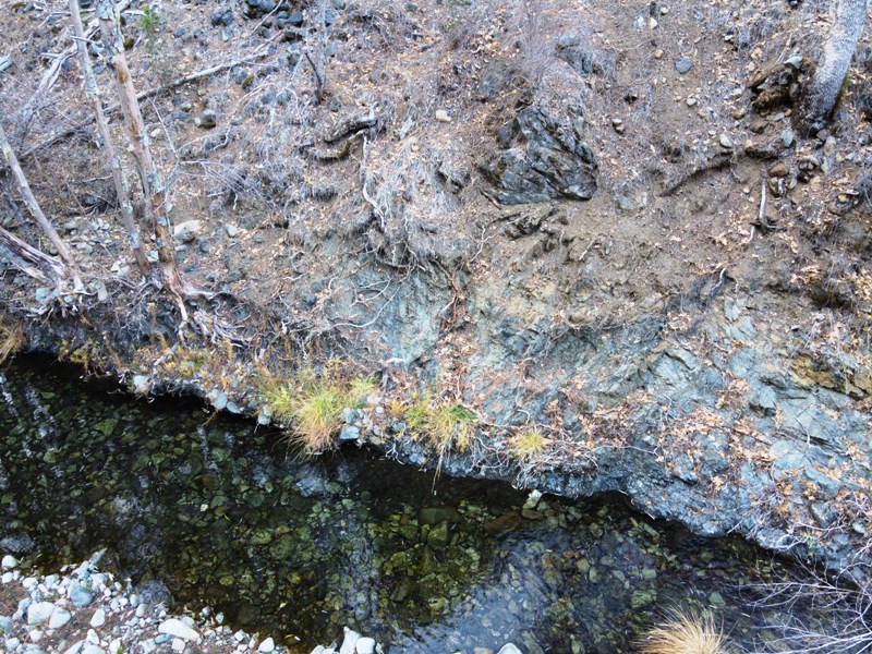
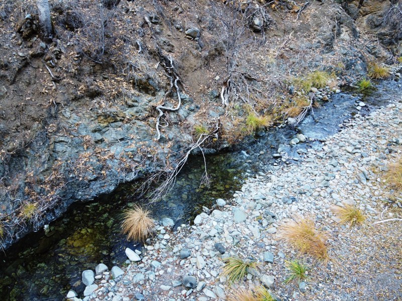
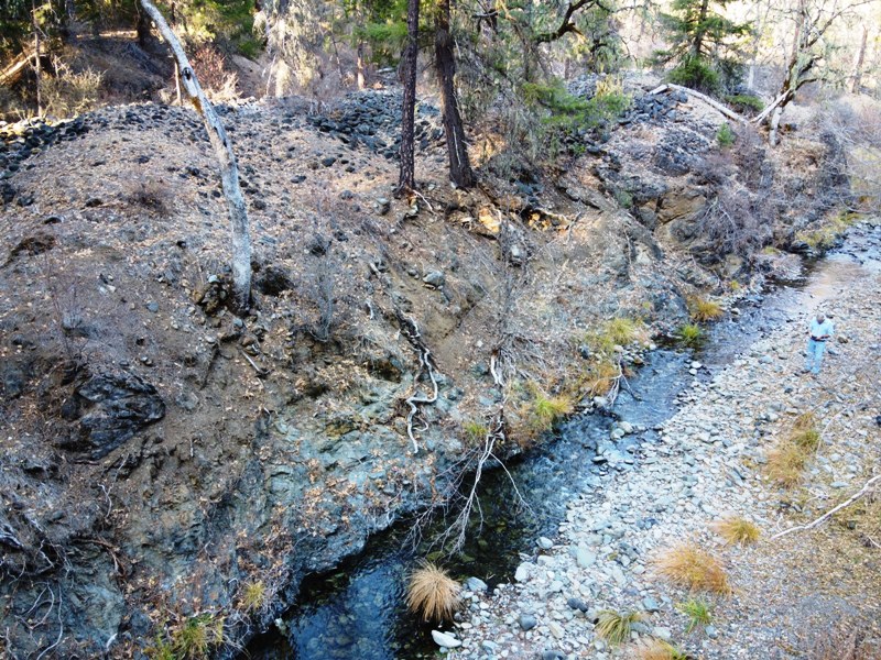
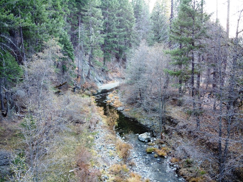
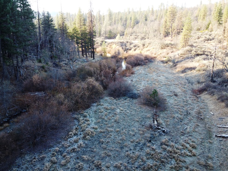
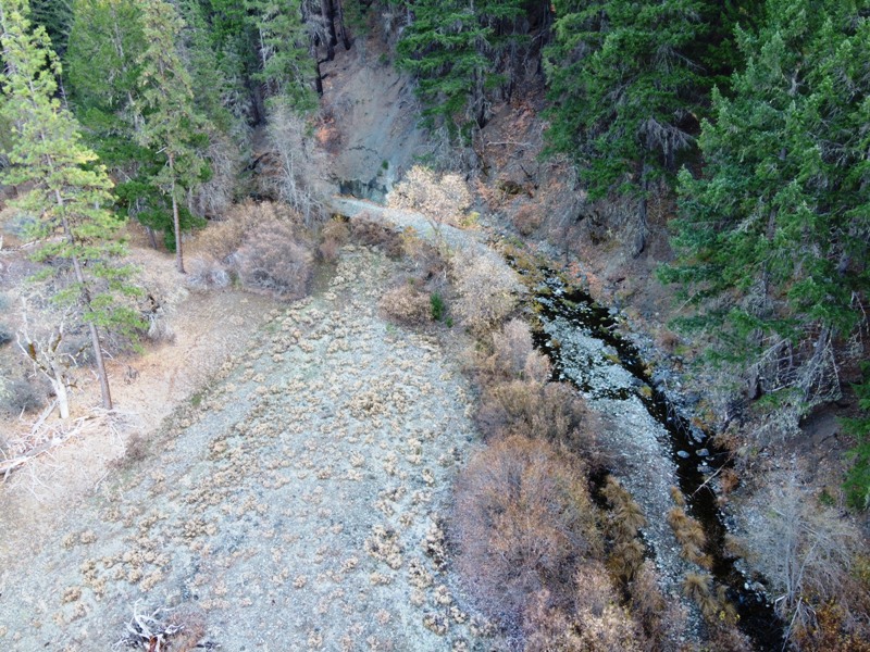
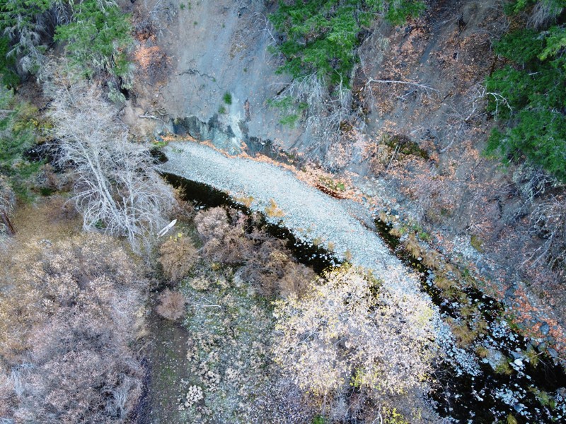
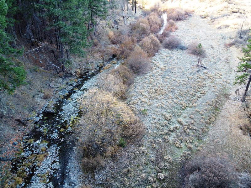
Tectonic uplift of the Trinity Mountains is legendary and is responsible for the steep and rugged topography with deep and incised valleys. Creeks and rivers in the Trinity Mountains usually contain nested bench gravel terraces from former uplifted erosional surfaces. East Hayfork Creek also has remnant bench gravel deposits, which are auriferous and have been hit hard by the historic miners. Tailings piles, rock walls, and water diversion ditches are common on the benches but as we all know, they did not get it all. Native gravels on bedrock can be seen all along the course of the creek. East Hayfork Creek is one of the richest drainages in the southern Trinity Mountains. Almost every reach of the stream has had some sort of mining activity, some of which has been very intense. Our 40-acre Roll in the Hay placer mining claim secures a long reach where the creek snakes through a bedrock outcrop. Above the bedrock narrow are nested remnant bench gravels. Through the narrows is a shoot where the creek is actively cutting down into the bedrock and exposes the bedrock gravel contact. Downstream from the narrows the valley opens up and exposes a wide and extensive sequence of terrace deposits. Up and until 1931, portions of East Hayfork Creek were extensively mined using a floating bucket-line dredge. Acres and acres of tailings piles carpet the lower reaches of the creek. The dredge stopped just at the western boundary to our 40-acre Roll in the Hay placer mining claim. Most of the mining efforts on the Roll in the Hay claim, and up valley from there, were done by hand using sluice channels that were fed by conveyance ditches that received their water from further up valley. There is an excellent trail by one of these ditches on the south hillside of the valley. The ditch would be breached and the water would wash down slope, over the auriferous gravels, and into sluice channels or sluiceboxes. Cobbles and large rocks would be moved as they were exposed and stacked on nearby unworked bank deposits. While you stand within the fields of tailings, it is pretty clear that the historic miners missed a lot! There are wide sections of unworked terrace deposits, tailings put on virgin material, and fractured bedrock that was never pried apart. The creek channel varies in width and evidence of high-water floods can be seen by the wood-debris wrapped around trees on the upper benches. The creek runs all year with the spring runoff often reaching above annual flood stage. Access to the claim is on the paved East Hayfork Road. There is a prominent pullout on the eastern part of the claim. A good trail leads down to the claim from there. The next side drainage is the eastern claim boundary. There is a good trail on the western part of the claim that leads down to an excellent campsite on a terrace about the bend of the in the creek. A small campfire ring and makeshift camp table between two trees identifies the campsite. The forest canopy is open in places but thick in others. Unclaimed ground on East Hayfork Creek is uncommon and our Roll in the Hay claim is situated on an ideal reach of the creek. It has numerous mining attributes and will provide more than a lifetime of prospecting fun. There is little doubt that you will find gold every time you go out and East Hayfork Creek has a history of coarse-grained gold. You will find nuggets and maybe a few chunks! One last thing, this claim would be ideal for a mini excavator or backhoe with a small wash plant. Permitting on Hayfork Creek is slow, so if you want to get a heavy equipment permit, it is best to start early. The Shasta-Trinity Forest personnel are incredibly untalented, inept and put mining interests at their lowest priority level. Nevertheless, we have been successful in getting permits, it just takes time. The mild winter weather at the 850' elevation allows the Roll in the Hay claim to be worked year-round. The cool clear water of East Hayfork Creek flows all year providing recreational activities such as fishing and swimming as well as prospecting. Just 10 miles from the town of Hayfork, the quiet seclusion of the Roll in the Hay claim is a great retreat with amenities close by. Click here Google Earth Fly To and see an aerial photo of Roll in the Hay and the claim boundries. Click here to Google Map it. Estimated GPS Coordinates:
Standard Information The Roll in the Hay placer mining claim is a non-patented federal mining claim. You will need to file appropriate annual paperwork to hold the property every year. (Ask us about our Filing Service to assist you with that!) BLM Fees & Advanced Geologic Transfer Fees Upon payment, the mineral claim will be transferred via a notarized Quitclaim notice filed in your name with Trinity County and the BLM. Limited payment terms and conditions are available; information available on request. Advanced Geologic has an exceptional annual claim paperwork filing system that will maintain your annual filings for any claim in the United States. Advanced Geologic reminds you that you MUST file annual notices with both the county in which the claim is located AND with the Bureau of Land Management by the appropriate dates. There are NO exceptions and errors will lead to the loss of your claim! Are your claims filed correctly? Advanced Geologic is a professional geologic consulting firm located in Chester, California. We not only sell quality mining claims, but we also help people work their claims. Our experience in resource evaluations, compliance and permitting and claim portfolio management allows our clients and buyers to go for the GOLD. Interested? Send us an email or call.
|
|
||||||||||||||||||||||||||||||||||||||||
|
Drone Photos
|
||||||||||||||||||||||||||||||||||||||||||
|
|