|
|
| Placer Mining Claims For Sale | ||||||||||||||||||||||||||||||||||||||||||
|
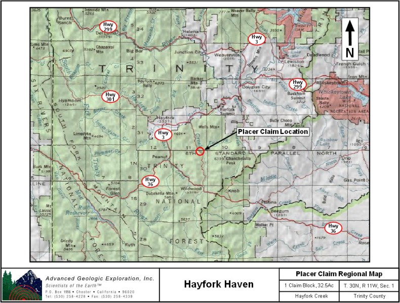
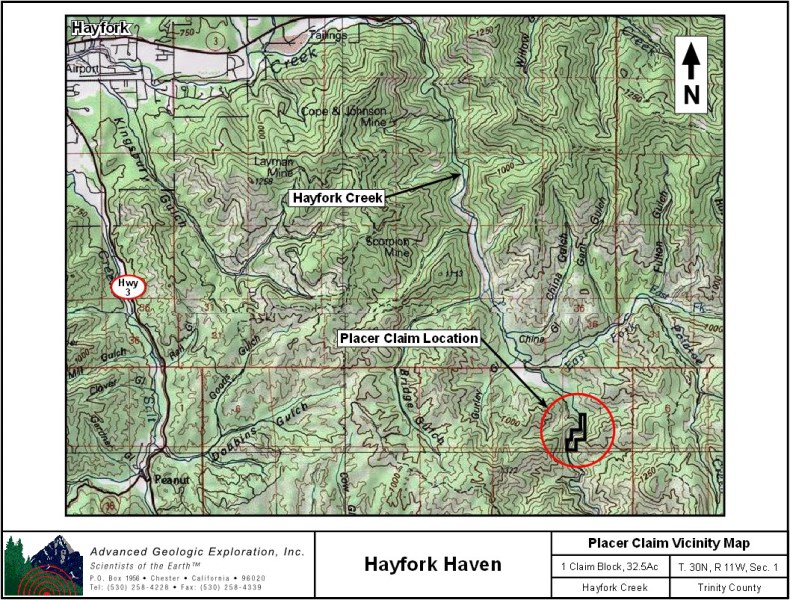
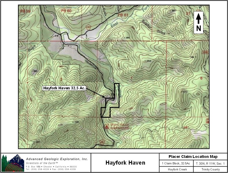
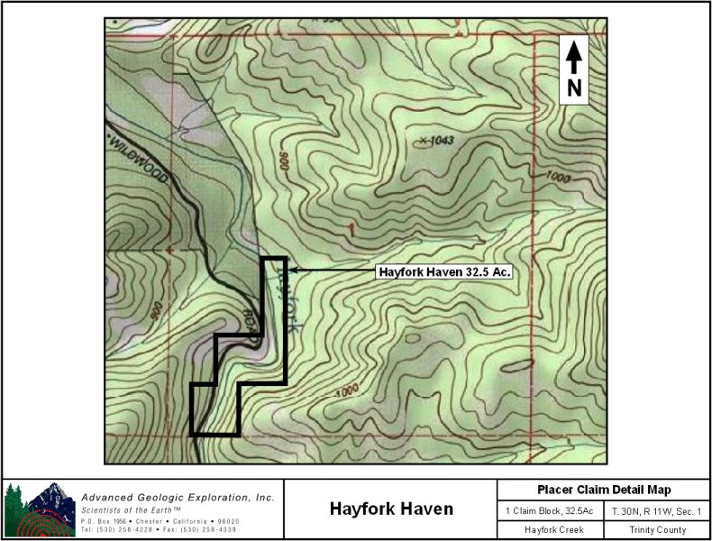
Hayfork Haven ±32.5 Acres
Price: $15,000 Up until 1931, Hayfork Creek and East Hayfork Creek were extensively mined using a floatation dredge. Acres of tailings intermixed with unmined, virgin ground remain on the Hayfork Haven claim. Bucket-line dredges were fairly good at getting nuggets out of the gravel but extremely inefficient at getting gold from crevices in the bedrock, which leaves a huge opportunity for modern day prospectors! Ample opportunities for the small time prospector to a production level mining operation exist on the High Hopes claim. A superb claim for metal detecting, sluicing, and highbanking to find the buried treasure! The surrounding area is scattered with historic mine sites and patented land lies adjacent to the High Hopes claim on 2 sides. Prior to 1994, to obtain a patent on a piece of ground, the miner had to prove that the prospecting on the property would support a family of 4 for a year. The existing patented properties prove the richness of the drainage. The claim is easily accessible by 2 wheel drive and has creek-side motorhome accessible camping. The mild winter weather at the 800' elevation allows the High Hopes claim to be worked year-round. The cool clear water of Hayfork Creek flows all year providing recreational activities such as fishing and swimming as well as prospecting. Click here Google Earth Fly To and see an aerial photo of Hayfork Haven and the claim boundries. Click here to Google Map it. Estimated GPS Coordinates:
Standard Information The Hayfork Haven placer mining claim is a non-patented federal mining claim. You will need to file appropriate annual paperwork to hold the property every year. (Ask us about our Filing Service to assist you with that!) BLM Fees & Advanced Geologic Transfer Fees Upon payment, the mineral claim will be transferred via a notarized Quitclaim notice filed in your name with Trinity County and the BLM. Limited payment terms and conditions are available; information available on request. Advanced Geologic has an exceptional annual claim paperwork filing system that will maintain your annual filings for any claim in the United States. Advanced Geologic reminds you that you MUST file annual notices with both the county in which the claim is located AND with the Bureau of Land Management by the appropriate dates. There are NO exceptions and errors will lead to the loss of your claim! Are your claims filed correctly? Advanced Geologic is a professional geologic consulting firm located in Chester, California. We not only sell quality mining claims, but we also help people work their claims. Our experience in resource evaluations, compliance and permitting and claim portfolio management allows our clients and buyers to go for the GOLD. Interested? Send us an email or call. |
|
|||||||||||||||||||||||||||||||||||||||||
|
Pictures to be added shortly!!! |
||||||||||||||||||||||||||||||||||||||||||
|
|