|
|
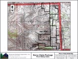
| Placer Mining Claims For Sale | |||
|
|
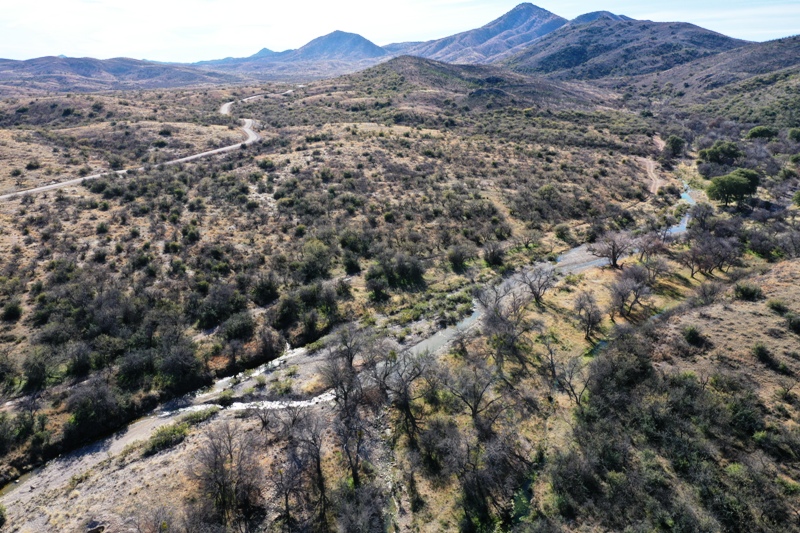
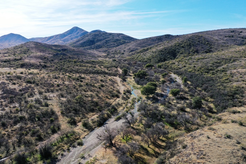
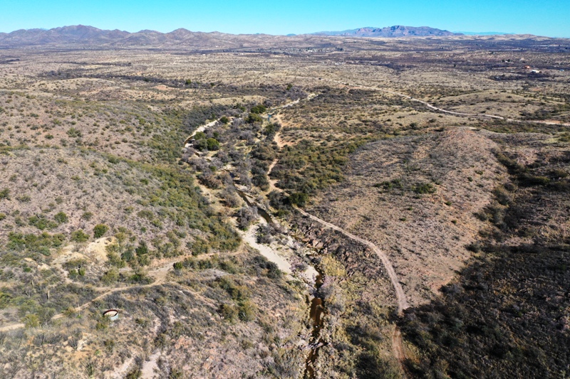
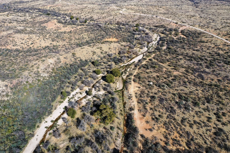
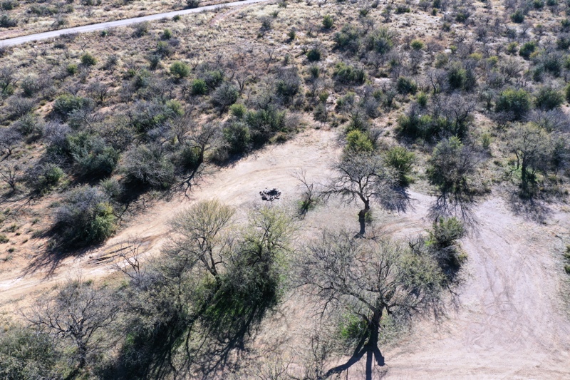
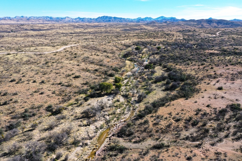
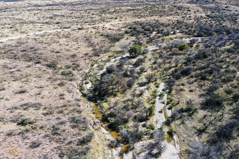
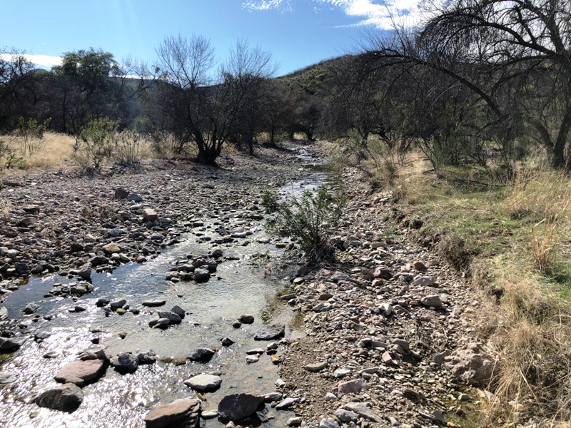
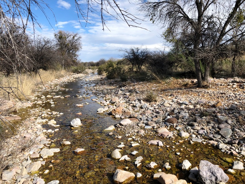
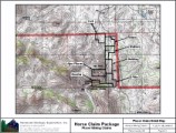
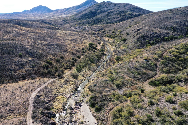
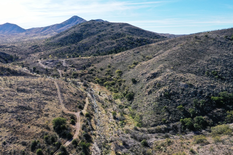
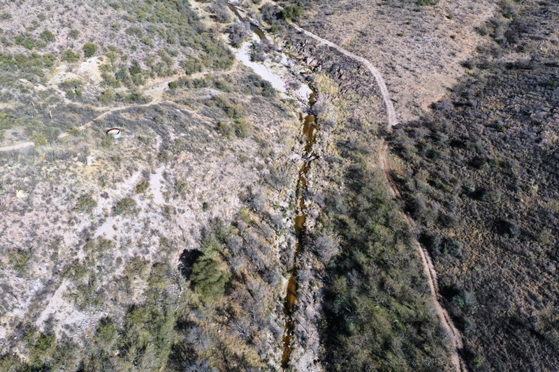
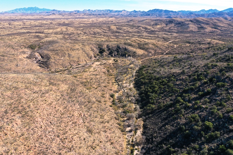
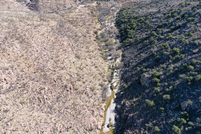
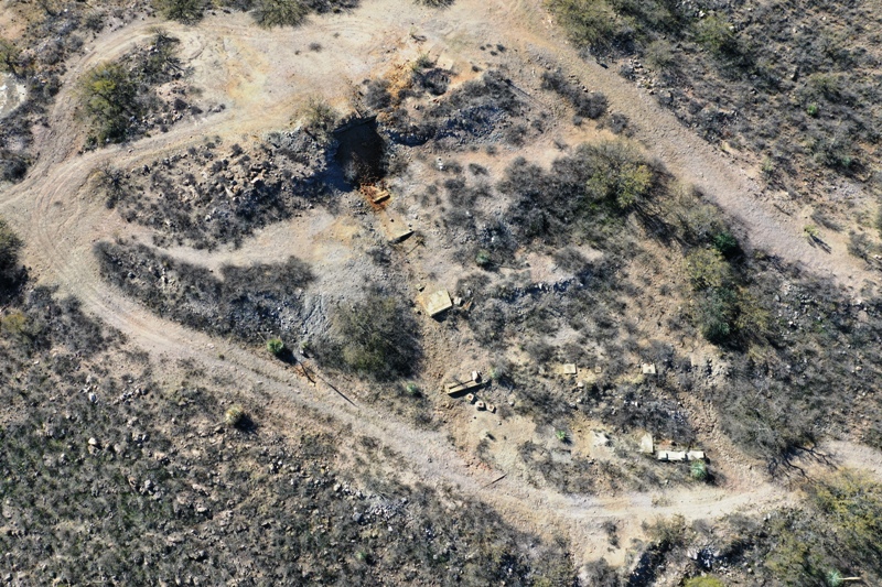
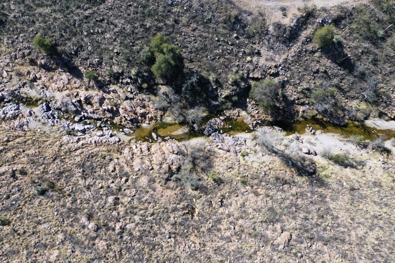
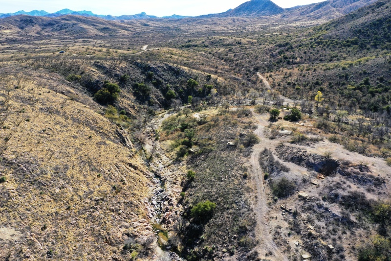
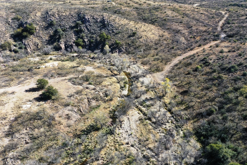
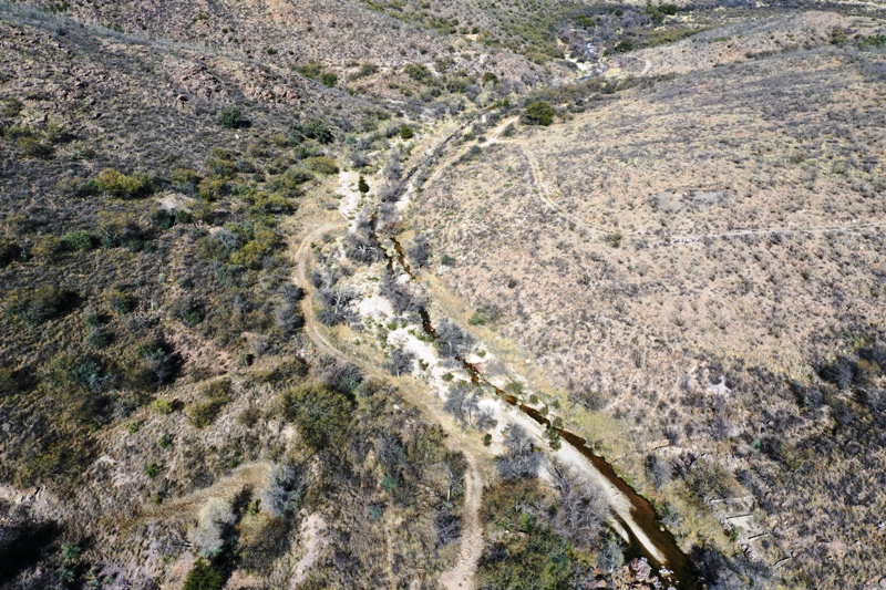
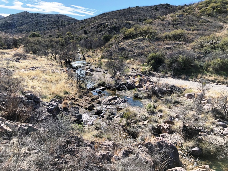
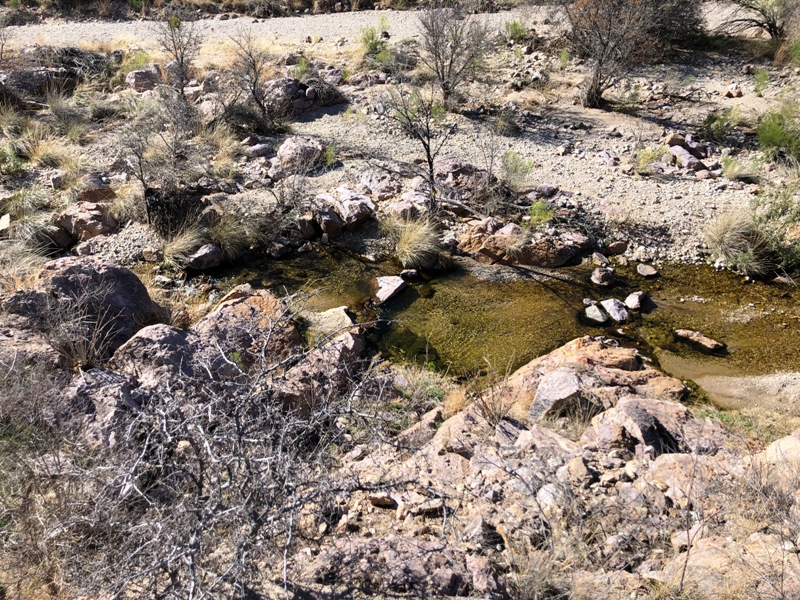
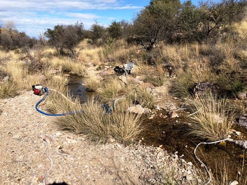
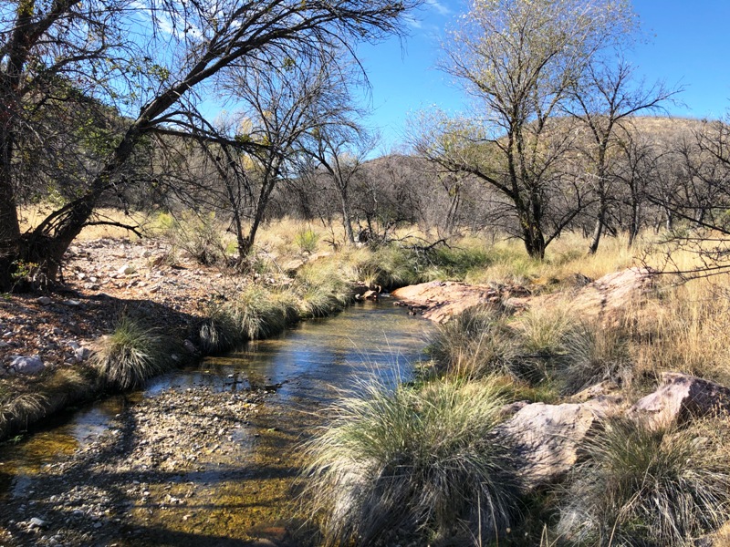
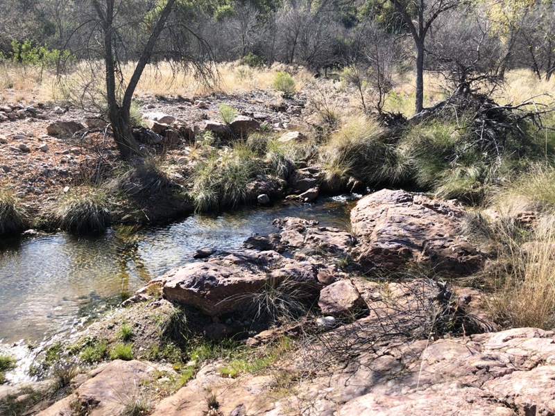
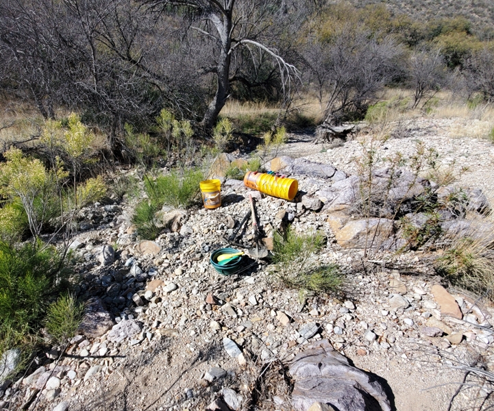
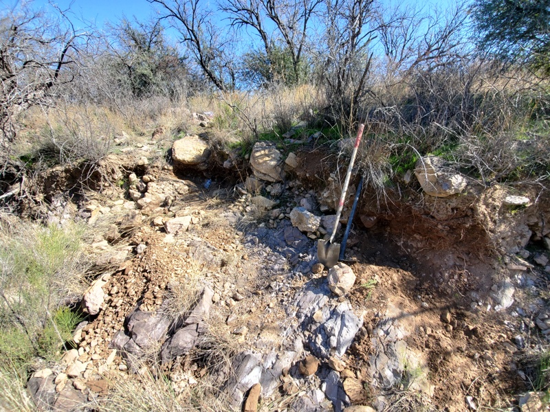
Colt, Mare, Stallion, Gelding AMC#'s: 459273, 459274, 459275, 459276, 459277, 459278, 459305 Placer Mining Claims ±140 Acres Price: $10,000 for each claim The Colt, Mare, and Stallion are set up for great production activity and the Gelding, Filly, Quarter, & Ajax Placer are perfect for dredging. While dredging is still not allowed in California it is legal here in in Arizona! This claim block has it all from production to dredging. The upper portion of the Horse Claim block consists of the Gelding, Filly, Quarter, and Ajax Placer 20-acre placer claims. They secure the active wash and its remnant bench deposits down wash from the famous Edwards and Ajax Mines and the Ajax Mine processing area. These lode mines consisted of rich gold in quartz veins that cut through the bedrock granite. Erosion from these mines, as well as from other veins in the mountains, locally contributed gold into the Fraguita Wash. There are also many upstream gold sources. There are extensive underground workings at these mines that were left remnant. Visible gold was common in the quartz veins and large clots of gold had been described. The Ajax Mine processing area consists of only remnants of the once active mill site. It appears that the ore was crushed and washed over a series of riffles and/or slick plates that captured the gold. All the wooden structures have been removed but the concrete foundations and building floors are still there. The National Forest Service has determined these features to have archeological significance and cannot be disturbed. And while the top of the claim is steep the bottom of the claim's aluvial material is very rich! The Quarter claim secures a long shoot in the wash just down wash from the Edwards Mine. Bedrock is shallow most of the way but there is a wide floodplain that contains a fair amount of material. These floodplain deposits cover older and probably unworked sediments. There are some hidden quartz vein digs towards the lower portion of the claim and they may go under the alluvial wash material. Just down wash from them would make an ideal place to start dredging. Bedrock is hard granite, but has cracks and fractures, which make for ideal nugget traps. Access to the upper Horse Claims is easy with an ATV, more challenging with a 4x4 as the road has been gullied by recent runoff. There is an easy creek crossing and the two-track leads down valley to the other claims. Camping is very good on each claim. Despite being located close to town, this is a remote area and it is unlikely you will see but a few people in any given day. Water is plentiful in the wet seasons and following thunderstorms. At the time these pictures were taken, snow melt and recent rains created excellent mining conditions. However, flash floods can be catastrophic and A) be prepared, and B) imagine how much gold is being brought down during those events! The Filly placer claim secures the hairpin bend in the river and the reach immediately down wash from the Ajax Mine processing area. The stream course is narrow and rocky, with plunge pools and catch basins. The inside bend has a superb gravel bar clearly covering bedrock, which has fractures crossing perpendicular to stream flow. The lower portion of the Filly claim has a relatively wide sediment bar that likely has some tailings from the Ajax Mine processing area. You know they did not catch all the gold in their riffles, which makes this gravel bar a prime target. The Gelding is the last claim in the narrow portion of Fraguita Wash. It secures the Ajax Wash, which is immediately down from the main Ajax Mine workings. This reach of the wash likely has the best opportunity to recover coarse-grained gold. Here the canyon widens to accept Ajax Wash sediment, then narrows through a bedrock gap before it opens up to the floodplain deposits below. There is not a lot of bank deposit but what is there sports significant opportunity for finding gold. It does not appear the “old guys” worked these deposits, so they’ve got to be rich! Some of the gravel bars seem to contain a good volume of material that could be explored with a mini excavator or similar. The lower Horse Claim block consists of the Stallion, Mare and Colt and they secure the expanding floodplain of Fraguite Wash. Beginning with the Stallion, the floodplain expands from a few tens of feet across to up to 200 feet wide. This is the drop zone for anything carried down wash. Two active channels contain water but a third channel was observed on the west side that likely carries water at high flow rates. There are large shade trees for when the sun get too hot in the middle of the day. These are likely protected trees. The creek anastomoses across the floodplain further down valley before narrowing again to a single channel at the southern part of the claim and near the camp site off the lower access road. Bedrock is relatively shallow across the floodplain, but there are likely deep pockets and the bench gravels should contain decent thicknesses of gravel. Here a backhoe and small trommel would be ideal. Of course, when the gravels are removed from the bedrock, the claimant could go in with a suction dredge and clean out the cracks. Once the wash rounds a western bedrock promontory, the creek takes a west turn and broadens out again. This is where the Mare claim begins. The promontory is likely influenced by a northeast trending side drainage that also drains upland with significant old prospects and maybe a future prospecting target. Bedrock seems to rise and fall down wash. Look for the large trees as they need more root zone to survive. Where the wash rounds the promontory bend there is an inside bend gravel bar containing large trees and an inside channel. This looks like a reasonable target to hit hard with a backhoe and small trommel. The Colt is similar to the Mare and together would make a good sized mining project. The bench deposit boundaries are well marked by large brush that suggest thick deposits. There is a substantial gravel deposit that is bounded by the active channel and a side channel. The gravel bar contains large trees and abundant large bounders. Bedrock depths seems to vary across the Colt claim's reach. The access road at the north end of the Colt claim begins on Arizona State Land and permission is required for its use. Nevertheless, the claim is easily assessed from the south and through the Mare claim. Location:
Arivaca is an unincorporated community in Pima County, Arizona. It is located 11 miles north of the Mexican border and 35 miles northwest of the port of entry at Nogales. Arivaca Road connects with I-19 at Amado about 23 miles to the northeast. It is another 33 miles north from Amado to reach Tucson or 29 miles south to reach Nogales. The elevation of Arivaca is approximately 3,643 feet and the population is roughly 900. Weather: At an elevation of 3,800 feet and positioned to capture weather rolling in from the South and West the climate is cooler and wetter than Tucson with highs ranging in the 100’s and lows into the teens. Rainfall ranges from 12-20 inches per year, most of which occurs during the spectacular summer monsoons. The National Weather Service has established June 15th through September 30th as the official monsoon season for the state. Arivaca has a semi-arid climate. History: The European-American history of the area dates back at least to 1695, although the community was not founded until 1878. Between 1916-1921, the U.S. Army maintained a presence in the Arizona border town of Arivaca. Initially there to protect the area from Pancho Villa during the Mexican Revolution, the Army remained to patrol the Mexican border during the first World War. The historic Arivaca mining district consists of over 100 old mines in the Las Guijas Mountains to the Northwest, the San Luis Mountains to the Southwest, and the Cobre Ridge to the Southeast of the town. Gold, silver, lead, copper and tungsten production has been recorded starting in Spanish colonial times and continuing intermittently through the 1950’s. The Oro Blanco Mining District itself had a total gold production estimated to be 126,500 oz of gold. Arivaca had a small population until the Tri Electric Cooperative power lines arrived in the valley in 1956. In 1972 Arivaca Ranch sold 11,000 acres to a land developer who subdivided the property into 40-acre parcels. Four years later, the dirt Arivaca Road was paved. In the 1980's and 1990's a small surge of people moved into the area, a medical clinic, fire department, arts council, human resource office, community center and a branch of Pima County Public Library were opened. The Arivaca district was one of the earliest areas in Arizona to be prospected and worked. The first Spanish explorers and settlers, in the late 1600's and early 1700's, extracted gold from the placers and mined the superficially enriched, weathered veins for gold and silver. Intermittent, small-scale mining continued in the succeeding years with reductions works located at Arivaca where water was available. The main deterrents were hostile Indian and bandit raids in the 1800's. The presence of tungsten was recognized in the early 1900's but not mined until World World I. The greatest activity in the district took place from the early 1930's to the early 1940's, when at least 100 prospectors and small miners eked out a living from working the gold placers and spotty vein deposits for gold and silver, as well as some tungsten. In 1935 there were over 35 small producing mines and prospects, mostly yielding a few tons of ore for the year. Since 1941 there has been only sporadic mining activity with little or no production. The total estimated and recorded production from lode mines through 1972 would be some 9,300 tons of ore containing about 5,300 ounces of gold, 45,500 ounces of silver, 115 tons of lead, 36 tons of copper, and 8 tons of zinc. A few thousand ounces of placer gold may have been produced prior to 1900 and about 350 ounces since then. The total number estimated and recorded value of the base and precious metal output from the Arivaca district be about $369,000.
Green Valley is 36 miles away and Tucson is 60 miles away. Both have lodging, restaurants, gasoline, plenty of shopping, and recreation.
The Lower Horse Claims: Stallion, Mare, and Colt
Standard Information Advanced Geologic is a professional geologic consulting firm located in Chester, California. We not only sell quality mining claims, but we also help people work their claims. Our experience in resource evaluations, compliance and permitting and claim portfolio management allows our clients and buyers to go for the GOLD. Interested? Send us an email or call. |
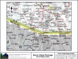
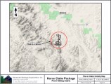
Click here to view GPS coordinates of each claim |
|
|
The Upper Horse Claims: Gelding, Filly, Quarter, & Ajax Placer
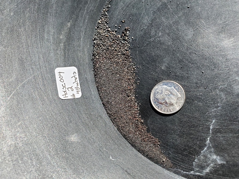
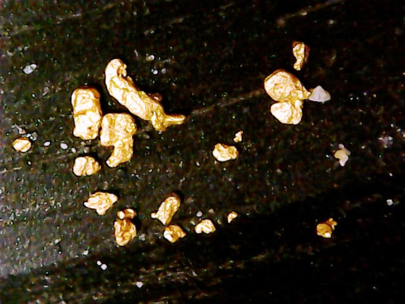
Sample Testing & Results
|
|||
|
|