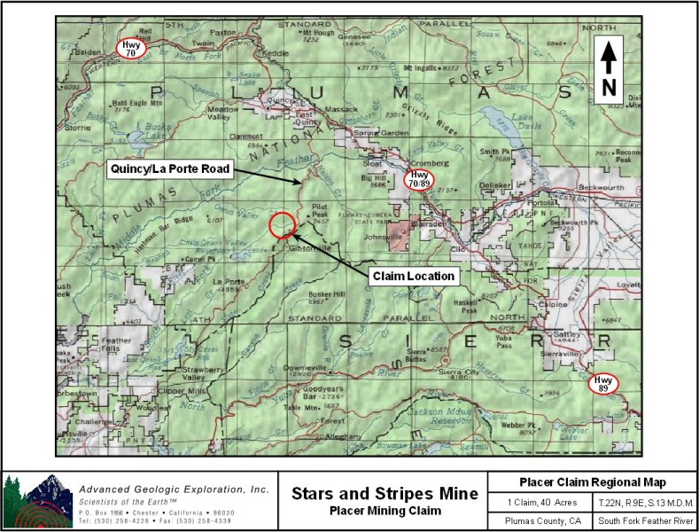
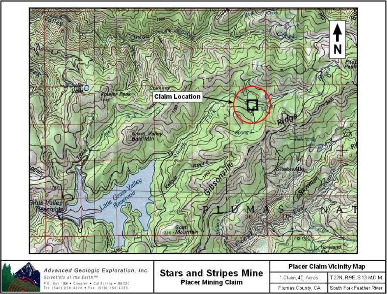
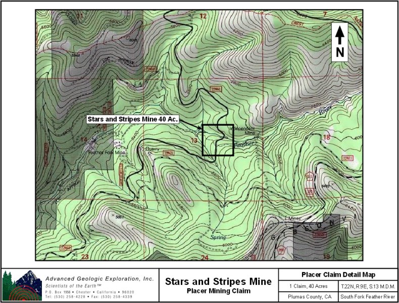
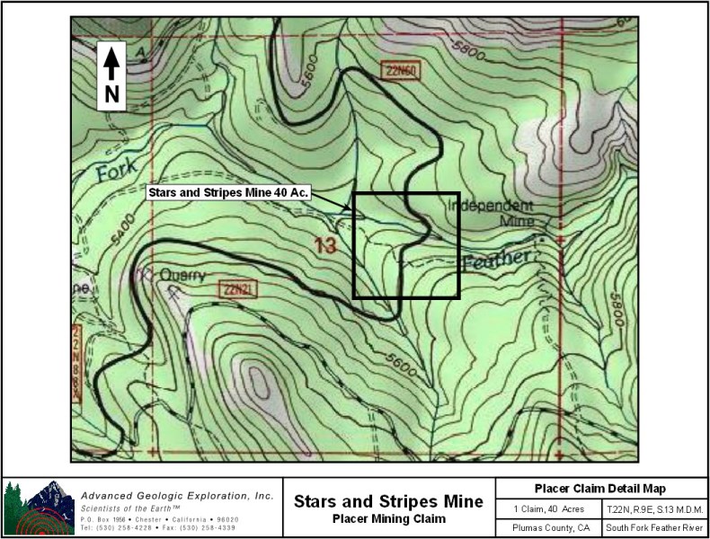
Stars and Stripes
Placer Mining Claim
40 Acres
Price: SOLD
Some amenities are:
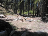
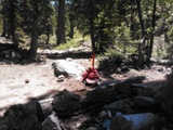
- Campsite on the claim.
- Excellent camping at National Forest Service campground at Little Grassvalley Reservoir (Running Deer Campground).
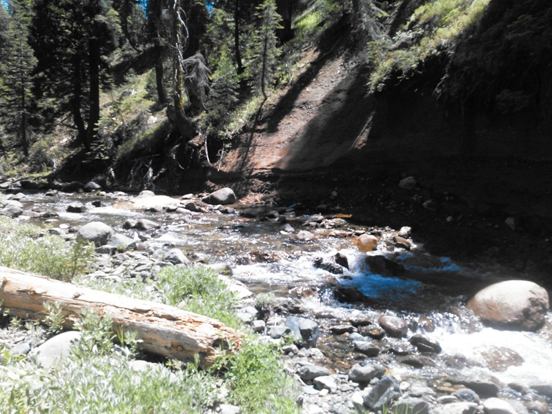
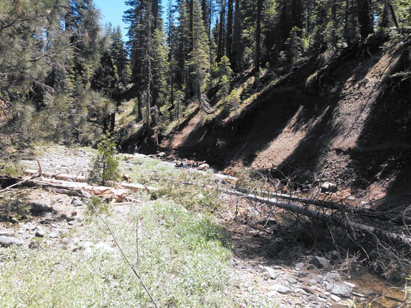
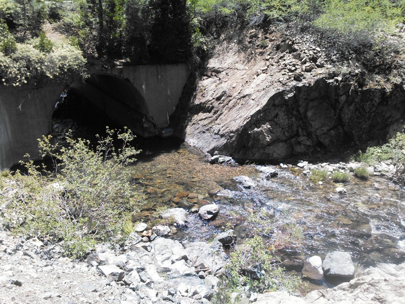
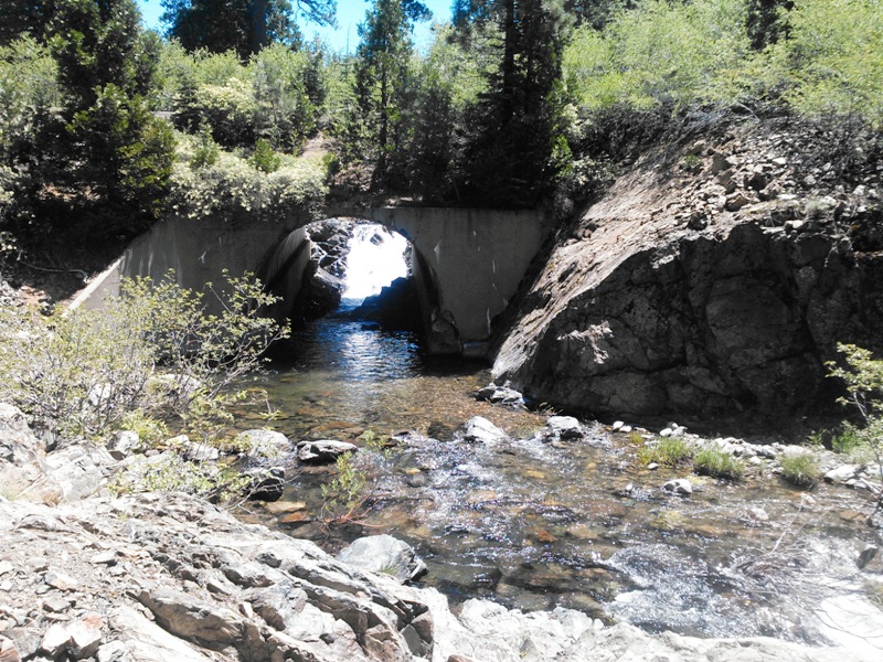
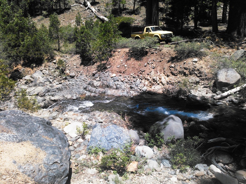
- 2wd access.
- Easy access to river - can pull vehicle up to claim.
- RV/Trailer/Motorhome friendly.
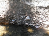
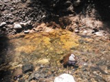
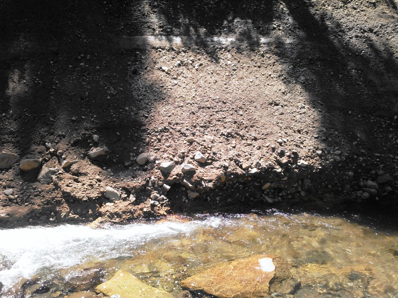
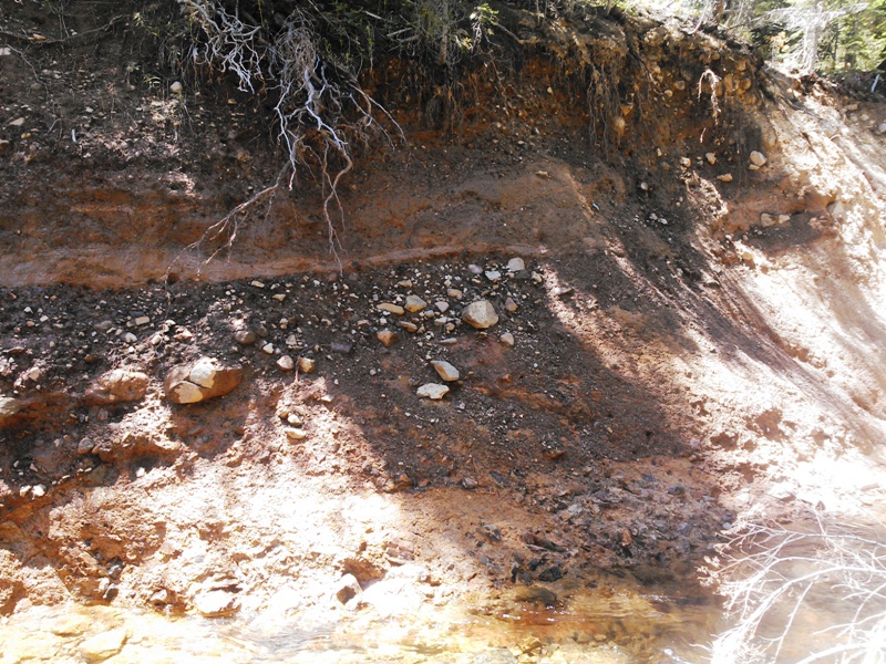
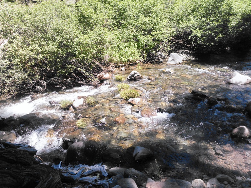
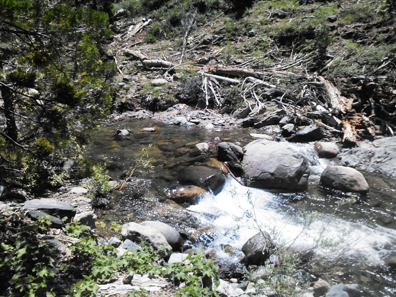
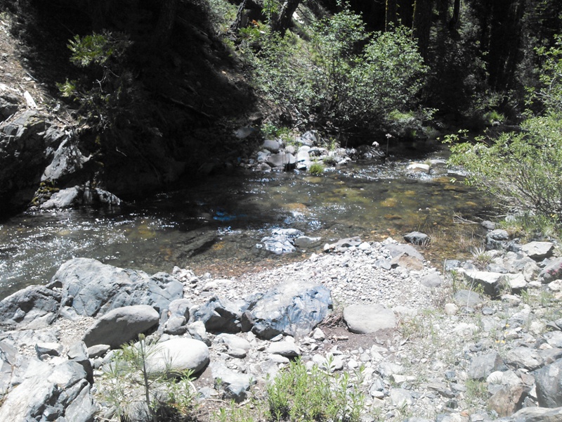
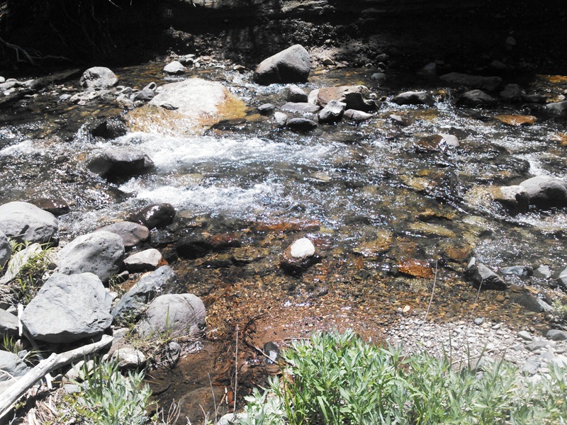
- Local gravels on bedrock.
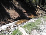
- Tailing piles, pools, and ponds.
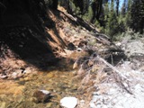
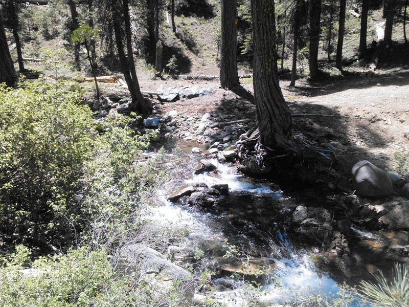
- Downed trees, tree roots, grass clumps, logs, ect.
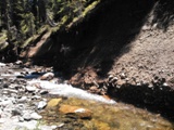
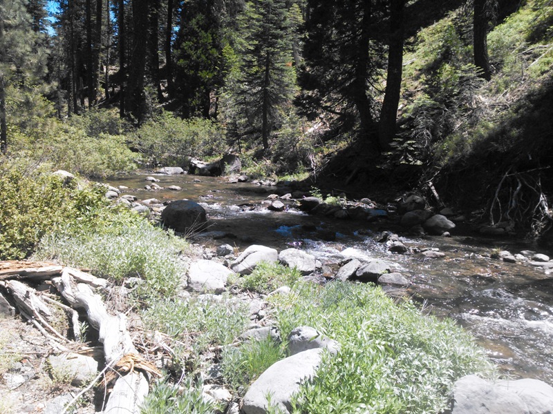
- Large gravel bars - river dump basin.
- Some remnant terraces.
- Tree roots & grass clumps, downed trees, logs, etc.
- Shallow water/slow current.
- Good swimming and fishing.
- Mining level: Recreational to intermediate.
- Quiet and safe area; very beautiful.
- Great fishing and nearby boating.
- Children and senior friendly - fun for all!
- Nearest town La Porte (few amenities but cute).
Click here to Google Earth Fly To view the Stars and Stripes placer mining claim and its boundaries.
Google Map it!
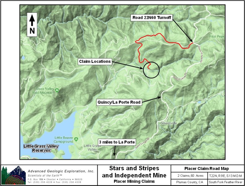
Pinpoint is at center of the claim where USF Road crosses over the South Fork Feather River.
Estimated GPS Coordinates:
Please adjust GPS to the following Datum & Coordinate display:
Datum: NAD27
Coordinates: Decimal Degree
|
Latitude
|
Longitude
|
Elevation
|
| Northeast Corner Boundary: |
|
39.76942° N
|
120.91825° W
|
5556 ft.
|
|
South Fork Feather River @ Northwest Corner Boundary:
|
|
39.76937° N
|
120.92291° W
|
5422 ft.
|
| Southwest Corner Boundary: |
|
39.76568° N
|
120.92297° W
|
5516 ft.
|
| Southeast Corner Boundary: |
|
39.76568° N
|
120.91835° W
|
5667 ft.
|
| USF Road 22N60 Enters/Exits Northern Boundary: |
|
39.76935° N
|
120.92060° W
|
5493 ft.
|
| USF Road 22N60 Enters/Exits Southern Boundary: |
|
39.76566° N
|
120.92085° W
|
5563 ft.
|
| USF Road 22N60 Crosses over SFFR @ Center of Claim: |
|
39.76801° N
|
120.91965° W
|
5450 ft.
|
| Access Road @ Western Claim Boundary: |
|
39.76818° N
|
120.92304° W
|
5422 ft.
|
| South Fork Feather River @ Eastern Boundary: |
|
39.76759° N
|
120.91819° W
|
5463 ft.
|
Standard Information
The Stars and Stripes placer mining claim is a non-patented federal mining claim. You will need to file appropriate annual paperwork to hold the property every year. (Ask us about our Filing Service to assist you with that!) Annual property tax assessment is approximately $1.12 an acre
Upon payment, the mineral claim will be transferred via a notarized Quitclaim notice filed in your name with Plumas County and the BLM. A $150 fee is assessed to handle the transfer. Limited payment terms and conditions are available; information available on request.
BLM Fees & Advanced Geologic Transfer Fees
Advanced Geologic has an exceptional automatic claim notice filing system that will maintain your annual filings for any claim in the United States. Advanced Geologic reminds you that you MUST file annual notices with both the county in which the claim is located AND with the Bureau of Land Management by the appropriate dates. There are NO exceptions and errors will lead to the loss of your claim! Are your claims filed correctly?
Advanced Geologic is a professional geologic consulting firm located in Chester, California. We not only sell quality mining claims, but we also help people work their claims. Our experience in resource evaluations, compliance and permitting and claim portfolio management allows our clients and buyers to go for the GOLD.
Interested? Send us an email or call.